Listen Now:
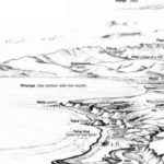
Iwi, hapu and land trusts are learning how geographical information systems can help them tackle issues faced by their communities, protect their history, and make better use of their assets.
A three day Indigenous Mapping Conference starts in Kirikiroa today.
Participants are learning how the technology tells their stories of connection with the land, rivers, and oceans.
Indigenous mapper Moka Apiti from Digital Navigators says participants will get hands on experience with the latest software tools from Google, ESRI and the open source QGIS tool set, and also hear how the technology can be applied to a wide variety of circumstances and needs.
"The theme is how do you go in the field and capture information. If you are doing a survey, it is not just mapping whenua, it's the connection to the land and how do you connect if you are doing a health survey or any kind of analysis type work," he says.
Mr Apiti says digital mapping could be critical to the creation of a new Maori Land Service as landowners look for titles, maps, aerial photography and other information in digital form.
 &
& 
Copyright © 2017, UMA Broadcasting Ltd: www.waateanews.com