


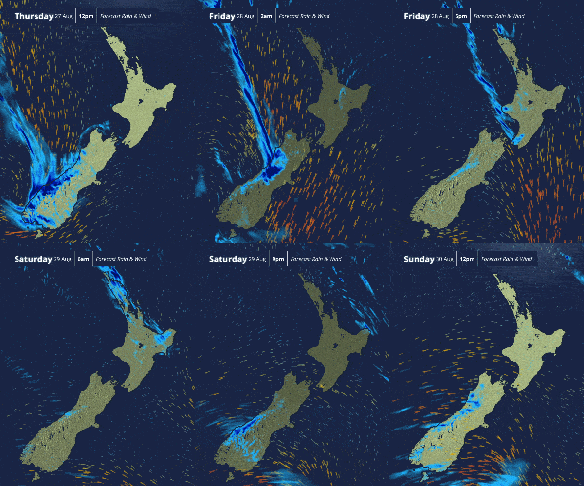

A powerful winter storm is slowly loosening its grip on Aotearoa, but forecasters are warning the country is not out of the woods yet, with heavy rain, snow and potentially severe gales expected to keep conditions unsettled through the weekend and into Monday.
The South Island remains at the centre of the current weather system, with heavy rain continuing along the West Coast and snow affecting inland and elevated areas.
MetService says the worst of the snowfall has now passed, but significant rainfall is continuing as the storm gradually weakens.
More than 300 millimetres of rain has been recorded around Franz Josef since the event began, leaving West Coast rivers running high.
Snow has meanwhile accumulated across a number of South Island alpine passes and elevated communities, disrupting travel and forcing road closures.
State Highways 73 and 94 have been affected by snow, with motorists being urged to check the latest NZTA road conditions before travelling.
Heavy rain warnings continue
The storm is expected to weaken further on Friday as it moves across the country, although that does not mean an immediate return to settled weather.
Further heavy rain remains possible across Westland and the Canterbury and Otago headwaters, where Orange Heavy Rain Warnings remain in place.
Rain will also spread into parts of the North Island.
Strong north to northwesterly winds are expected across central New Zealand, with Yellow Strong Wind Watches covering Wellington, southern Wairarapa and the Marlborough Sounds before conditions begin easing from the south.
Another unsettled Saturday
Saturday brings another round of unstable conditions.
A complex trough is forecast to affect the central and upper North Island while a cold front moves across the lower South Island.
Heavy rain is possible around the eastern ranges of Bay of Plenty, with showers and rain affecting other parts of the motu.
For whānau travelling, attending weekend events or heading into rural and remote areas, the rapidly changing conditions mean forecasts and road information will need to be checked regularly.
Severe gales possible Sunday and Monday
Attention then turns to another significant feature of the forecast.
From Sunday, a strong west to southwest flow is expected to spread across New Zealand, bringing another series of fronts and troughs.
MetService says severe gales are possible in exposed parts of central and southern New Zealand on Sunday and Monday.
Western and southern areas are expected to bear the brunt of further periods of rain, while strong winds could create additional problems for travel and outdoor activities.
Conditions should gradually improve later on Monday, although showers and strong winds could linger in some areas.
With rivers already elevated, significant rainfall recorded and snow affecting parts of the transport network, people are being urged not to assume the weakening of the current storm means the weather threat has passed.
Winter still has plenty left in the tank — and for much of Aotearoa, it could be a wet, windy and wild weekend ahead.
#Weather #WinterWeather #MetService #WeatherWarning #HeavyRain #Snow #SevereGales #WestCoast #FranzJosef #SouthIsland #TeWaipounamu #BayOfPlenty #Wellington #Wairarapa #Marlborough #Canterbury #Otago #Westland #RoadClosures #NZTA #TravelAlert #Storm #AotearoaWeather #RegionalNews #MaoriNews #WaateaNews #RadioWaatea #WaateaDigital


